160 km. 13 days. A full traverse of the entire length of the Gariwerd landscape.
The Grampians Peaks Trail (GPT) is Victoria’s newest world-class hiking trail and the longest in Parks Victoria’s ‘Walk Victoria’s Icons’ series.
 It begins at Mount Zero, the very northern tip of the Grampians mountain range, around 3 hours west of Melbourne. From there it explores valleys, ridges, waterfalls and peaks through a wide range of environments 160 km southward to Dunkeld. It journeys through both the physical and cultural landscapes as you witness evidence and learn the stories of the oldest living culture in the world.
60 km of exiting trail networks have been upgraded and linked together with an additional 100 km of new trail construction to rediscover and explore parts of the landscape that have previously been inaccessible.
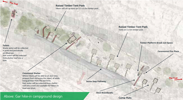
12 new environmentally sensitive hiker camps are being constructed along the route to enable a single continuous journey for adventurous through-hikers looking to undertake the mighty challenge.

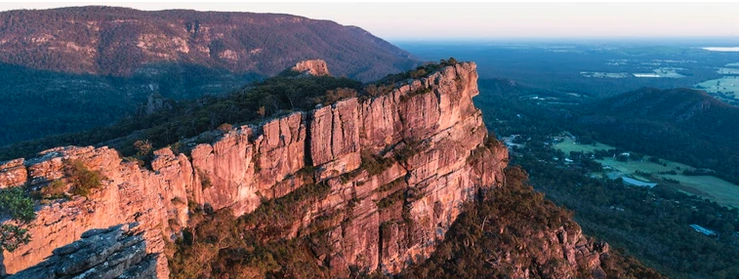
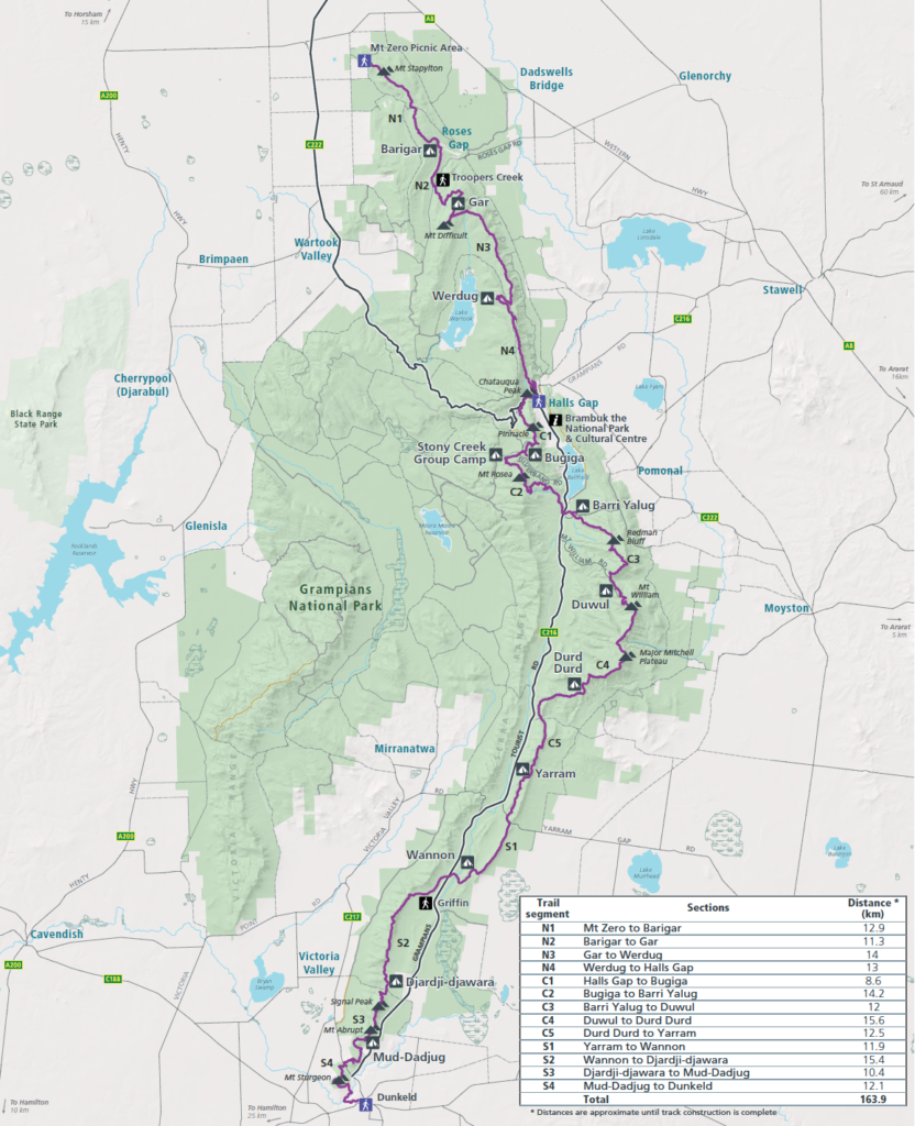
The GPT is broken down into 3 main stages, North, Central and South, each with its own trailhead. The North starting at Mount Zero finds it’s way to Halls Gap over 4 days and 3 nights and explores the stunning and dramatic rocky landscape that is typical in northern Gariwerd.

The Central Stage picks up in Halls Gap, traverses the Wonderland Range and visits iconic sites such as the Grand Canyon and the Pinnacle then continues over Mount Rosea, up Mount William, the highest peak in the range, and then across the remote Major Mitchel Plateau. It is the longest stage taking 5 days and 4 nights to complete.
In the South, the traverse continues for another 4 nights onto the Serra Range, the final dramatic, whipping tail of the Grampians. Sharp ridgelines and high escarpments dominate the last few days of this journey as it continues to the finish line in Dunkeld.

On the Grampians Peaks Trail map, along the 13-day route, there is a fantastic amount of access to the trail, which means you don’t need to commit 13 days to hike its entirety in one effort. There are amazing opportunities to hop on and off the trail for fantastic day walks as well as shorter overnight adventures. Check out our Grampians Peaks Trail map below:

With the entire Grampians Peaks Trail opening in November 2021, there is no better time to make your plan and get out and experience the GPT in whichever way suits you.
Whether it be a series of day walks, a weekender or the whole 13 days, the GPT has something to offer you. And whether you’re walking indecently or looking to join a guided walk, the Grampians Peaks Walking Company is here to help.


